| Skip
to content |
|
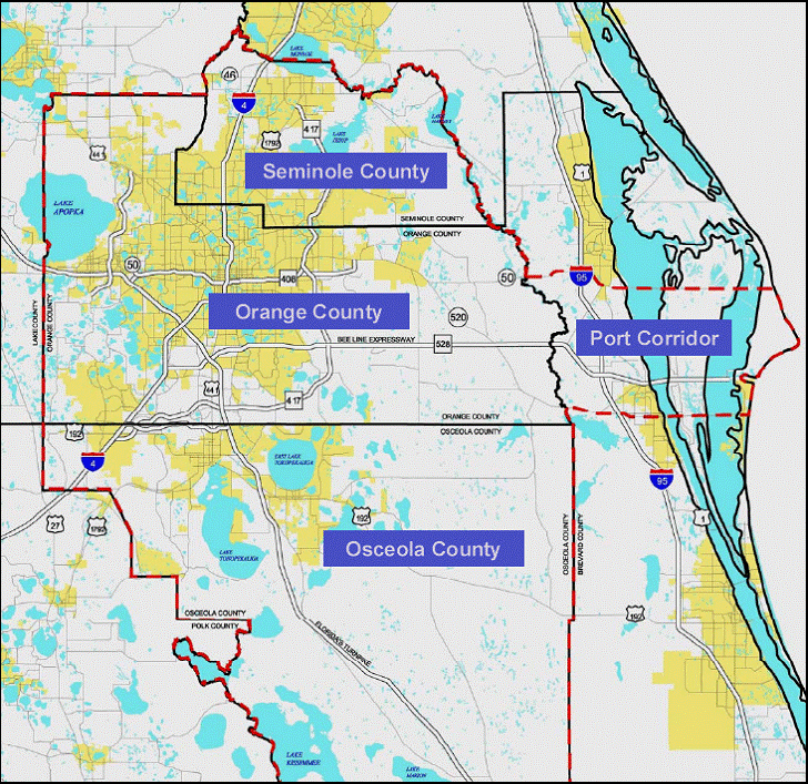
Urban Freight Case Studies - OrlandoGeographic DescriptionThe study area includes most of Central Florida, which encompasses Orange, Osceola and Seminole Counties, as well as the area surrounding the Bee Line corridor stretching to Port Canaveral through Brevard County (Figure 1). Central Florida is home to approximately 2.03 million people.2 Figure 1: Project Area Map
Source: Metropolitan Orlando Regional Transportation Partnership, Central Florida Freight, Orlando, the largest city in Central Florida, is accessible by vehicle via several major highways, including I-4, which begins in Daytona Beach and ends in Tampa. Because it is a key connector to downtown Orlando, industry, suburbs, tourist attractions, and both coasts, I-4 is heavy traveled and congested. SR 408 (East-West Expressway) also is a key artery to and from the city's eastern and western suburbs. Additionally, the Orlando area is served by one through railroad, CSX Transportation's A line (formerly the Atlantic Coast Line Railroad's mainline) and several spurs, primarily operated by Florida Central Railroad. Amtrak passenger service runs along the CSX A line. The region enjoys high freight activity because of its location between two busy freight centers—Jacksonville and Miami. Between 50 to 60 percent of Florida's north-south goods movement flows through the Orlando area.3 2 U.S. Department of Commerce, Census Bureau, Population Estimates, Metropolitan Statistical Areas (Washington, DC: 2008). 3 Metropolitan Orlando Regional Transportation Partnership, Freight, Goods and Services Mobility Strategy Plan (Orlando, FL: 2003). |
|
United States Department of Transportation - Federal Highway Administration |
||