FHWA Work Zone Project Coordination Webinar
slide 1: Work Zone Project Coordination – Michigan's I-94 Corridor and the Great Lakes Megaregion
Bobbi Welke, Southwest Region Engineer
Michigan Department of Transportation
Peter Rafferty, ITS Program Manager
Wisconsin TOPS Lab, University of Wisconsin-Madison
September 24, 2012
Download the Printable Version [PDF, 3.3 MB]
PDF files can be viewed with the Acrobat® Reader®.
slide 2: Overview
- Michigan's I-94 Corridor
- GLRTOC
- Partners & Mission
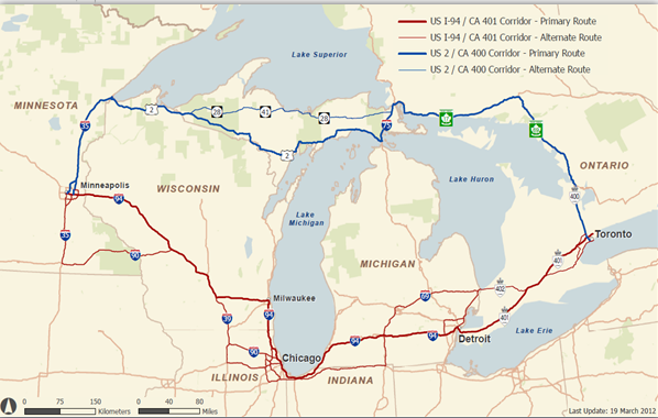
- Geographic Area
- Work Zone Coordination
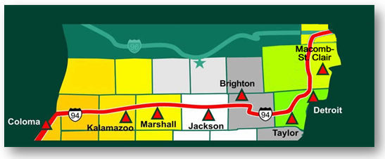
slide 3: MDOT Structure/I-94 Corridor
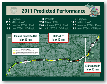
slide 4: 2011 Predicted Performance
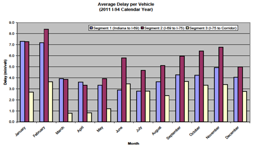
slide 5: Average Delay per Vehicle
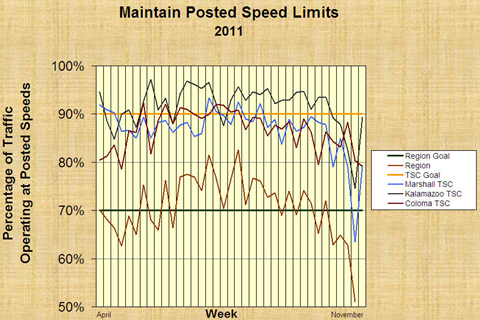
slide 6: Main Posted Speed Limits 2011
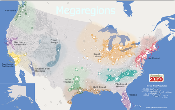
slide 7: Megaregions
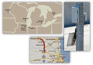
slide 8: GLRTOC Partners & Mission
- Chicago Skyway / Indiana Toll Road
- Illinois DOT
- Illinois Tollway
- Indiana DOT
- Michigan DOT
- Ministry of Transportation Ontario
- Minnesota DOT
- Wisconsin DOT
| Improve cross-regional transportation operations in support of regional economic competitiveness and improved quality of life. |
slide 9:
slide 10: GLRTOC Strategies
- Three Strategic Focus Areas
- Efficient freight operations
- Reliable mobility
- TIM / ETO
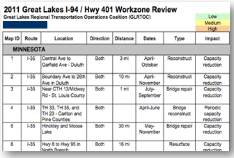
slide 11: Annual Work Zone Preview
- LMIGA has been doing this for years for the Chicago region
- Among the first efforts of GLRTOC
- Held first week of February in Chicago
slide 12:
slide 13:
slide 14: GLRTOC MCOM Award
- Multi-State Corridor Operations & Management award for:
- Center to Center Communications
- Smart Work Zone Coordination
slide 15: Smart Work Zone Coordination
- Three tasks:
- Annual work zone preview enhancements
- Work zone mapping application
- Work zone performance monitoring
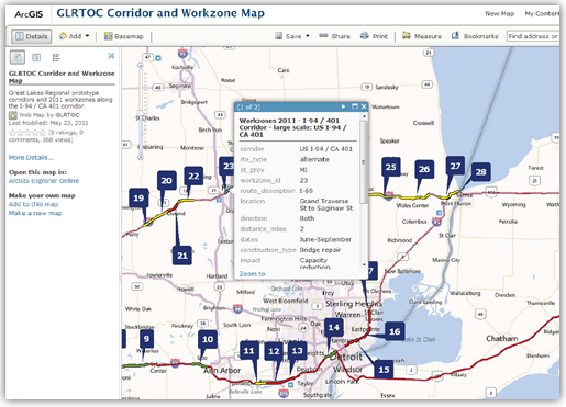
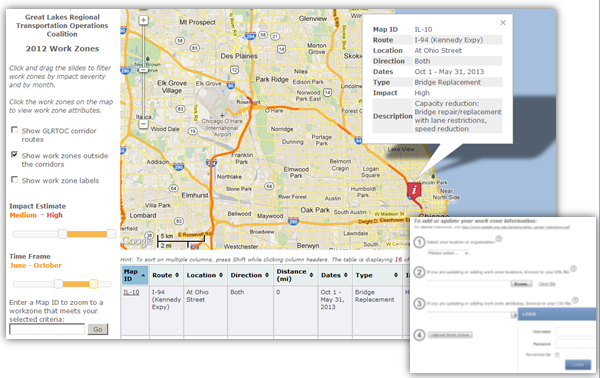
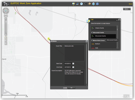
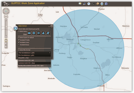
slide 16: 2. Work Zone Mapping Application
slide 17:
slide 18: 3. Smart Work Zone Monitoring
- Pilot test segment is I-39/90 between Madison, WI and Rockford, IL
- 65-mile mostly rural corridor
- Minimal detection available
- Three agencies
- Multiple medium and high impact work zones