
|
|
||
2024 FHWA Solar Eclipse Interstate Map w/Safety Tips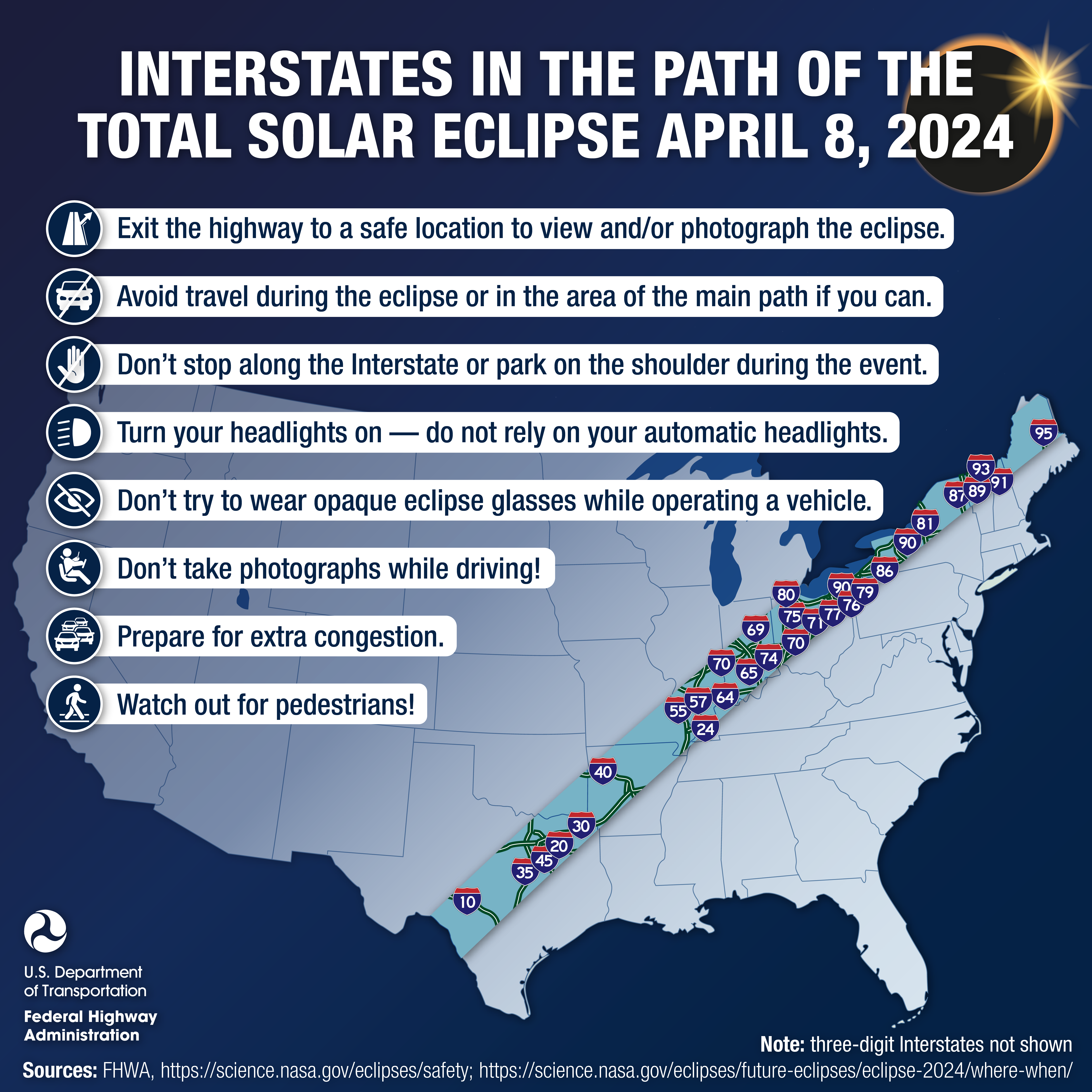
Map of US Interstates in the path of the total solar eclipse April 8, 2024. The solar eclipse's path of totality will be visible in the contiguous U.S. starting in south central Texas at 13:30 CDT. The path will then advance northeast with totality being visible in parts of Texas, Oklahoma, Arkansas, Missouri, Kentucky, Illinois, Indiana, Ohio, Pennsylvania, New York, Vermont, New Hampshire, and northern Maine at 15:35 EDT. Providing Safety Tips: Exit the highway to a safe location to view and/or photograph the eclipse. Avoid travel during the eclipse or in the area of the main path if you can. Don't stop along the Interstate or park on the shoulder during the event. Turn your headlights on – do not rely on your automatic headlights. Don't try to wear opaque eclipse glasses while operating a vehicle. Don’t take photographs while driving! Prepare for extra congestion. Watch out for pedestrians!
For additional information, please Contact Us. |
||
| US DOT Home | FHWA Home | Operations Home | Privacy Policy | ||